header print

Learn Something New About the World With These Cool Maps

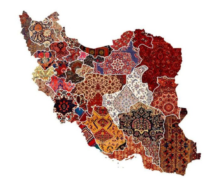
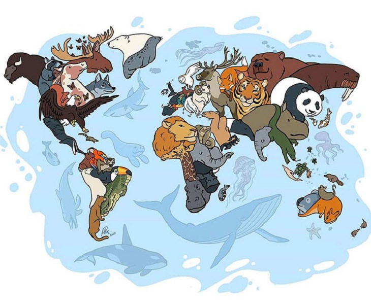
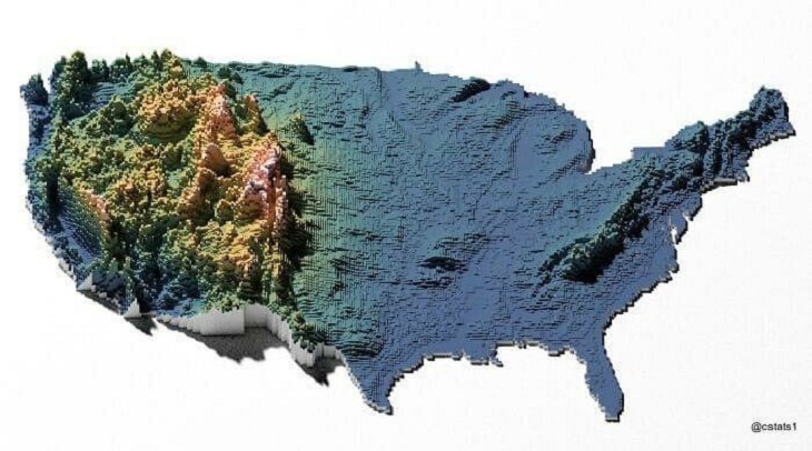
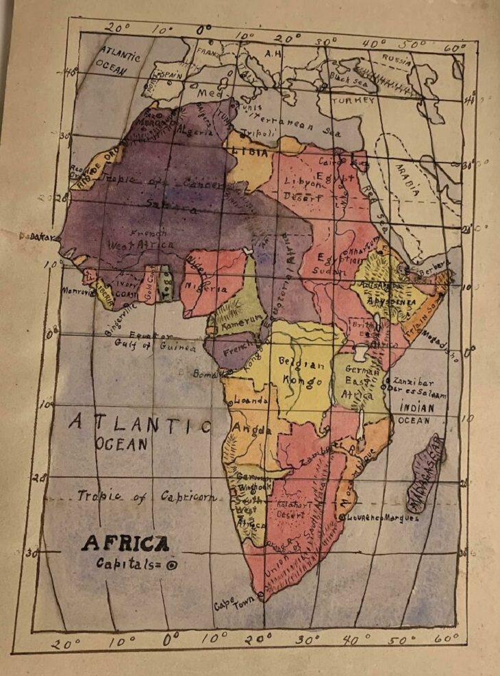
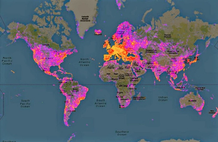
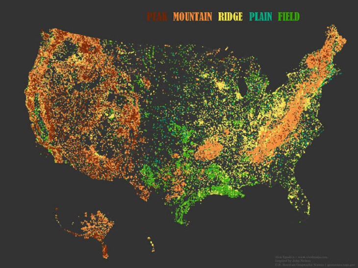
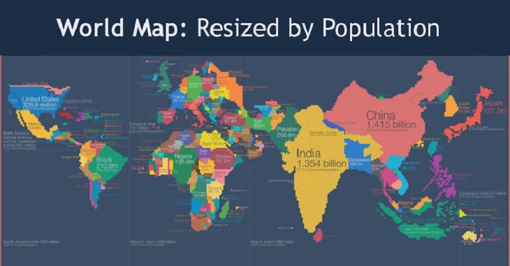
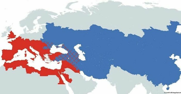
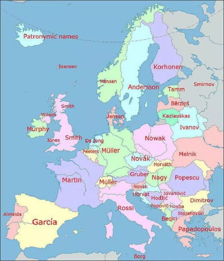
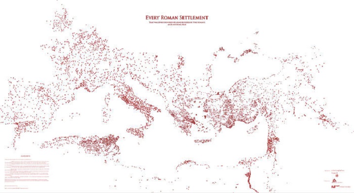
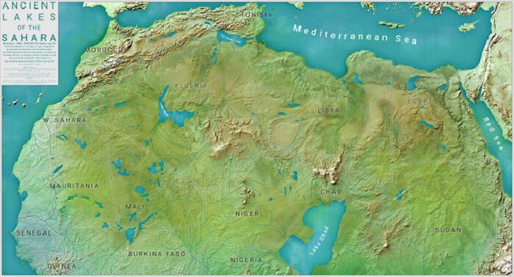
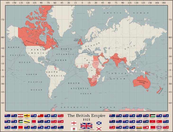
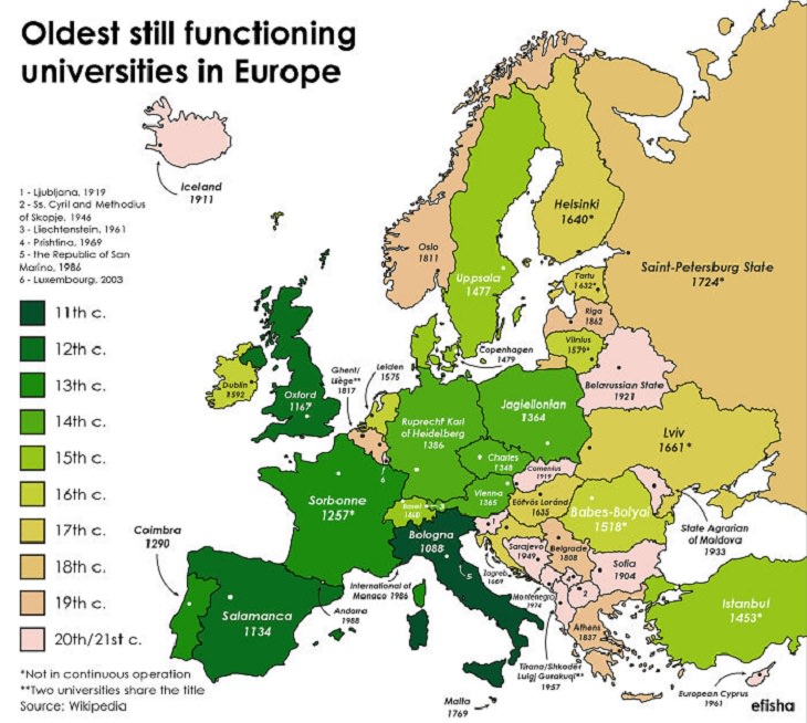
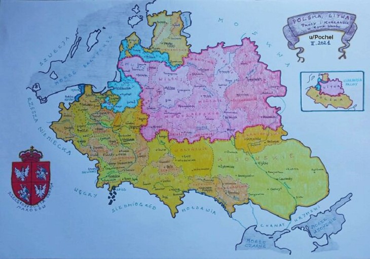
Who doesn’t love looking at a fun map? No, we don’t mean the tedious ones we had to learn back in our school days. We are talking about the informative and insightful maps that make us think. In this article, for example, we featured 15 cool maps that offer a unique perspective of our world. From a map of the animals of our planet to one of the most photographed places in the world, these fascinating maps will certainly teach you something new and exciting.

See Also: These World Maps Made Me See the World in a New Way!

1. A map of the regional rug patterns of Iran

Informative Maps,  rug patterns of Iran
Image source: Reddit

2. The animals of the world map

Informative Maps, Animals of the world
Image source: Reddit

3. 3D United States elevation map

Informative Maps, United States elevation map
Image source: Reddit

4. An old hand-drawn map of Africa in the 1910s

Informative Maps, Africa
Image source: Reddit

5. A map that shows all of the world's roads

Informative Maps,  world's roads
Image source: Reddit

6. The map of most photographed places in the world

Informative Maps, most photographed places
Image source: Reddit

7. Place names that contain the word 'Peak', 'Mountain', 'Ridge', 'Plain' and 'Field' in the United States

Informative Maps, United States
Image source: Reddit

8. The world map resized according to population

Informative Maps,  population
Image source: Reddit

9. The Roman Empire vs. the Mongol Empire at their peak

Informative Maps, The Roman Empire vs. the Mongol Empire
Image source: Reddit

10. The most popular last names in Europe

Informative Maps, Europe
Image source: Reddit

11. A map of Every Roman settlement

Informative Maps, Roman settlement
Image source: Reddit

12. The ancient lakes of the Sahara

Informative Maps, Sahara
Image source: Reddit

13. The British Empire at its territorial peak

Informative Maps,  British Empire
Image source: Reddit

14. The oldest universities in Europe that are still open

Informative Maps,  universities in Europe
Image source: Reddit

15. A hand-drawn map of the Polish-Lithuanian Commonwealth, also known as the Crown of the Kingdom of Poland and the Grand Duchy of Lithuania, in 1618

Informative Maps, Polish-Lithuanian Commonwealth
Image source: Reddit
Share this post with your friends and family!
Next Post
Sign Up for Free Daily Posts!
Did you mean:
Continue With: Google
By continuing, you agree to our T&C and Privacy Policy
Sign Up for Free Daily Posts!
Did you mean:
Continue With: Google
By continuing, you agree to our T&C and Privacy Policy