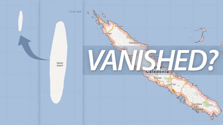
1. Sandy Island
Supposedly discovered in 1876 by the French, Sandy Island was said to be located between the Nereus Reef and the Chesterful Islands in the territory of New Caledonia in the Coral Sea. Despite being added to most modern maps, and even Google maps, an Australian ship called the Southern Surveyor went to its supposed location in 2012 only to discover that there was absolutely nothing there!
2. Pepys Island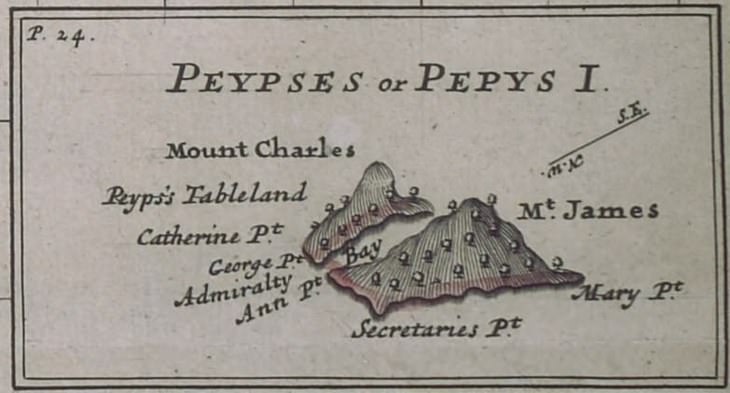
Way back in 1683, a man named William Ambrose Cowley claimed that he discovered this island at a latitude of 47, north of the Falkland Islands. He said it was entirely uninhabited, and that it contained forests with fresh water running through them, and he named it Pepys Island in honor of the secretary to the Admiralty, Samuel Pepys. During the 18th century, there was many an expedition to locate the island, all of which ended in failure.
3. Saxemberg Island
Saxemberg Island was allegedly first seen by Dutch seafarer John Lindestz Lindeman in 1670. As with the tale of Pepys Island, all further attempts to locate this island ended in failure and the tale eventually died out. However, in the 1800s, people once again began to report sightings, yet no captain who ever saw it actually stopped to set foot on it, and so the mystery lives on...
4. Sarah Ann Island
Originally sighted north of the equator by an American guano company, Sarah Ann Island was a major disappointment for the US Navy. This is because the United States Pacific Fleet made plans to use the island to observe 1937's solar eclipse, yet were utterly unable to locate it.
5. Rupes Nigra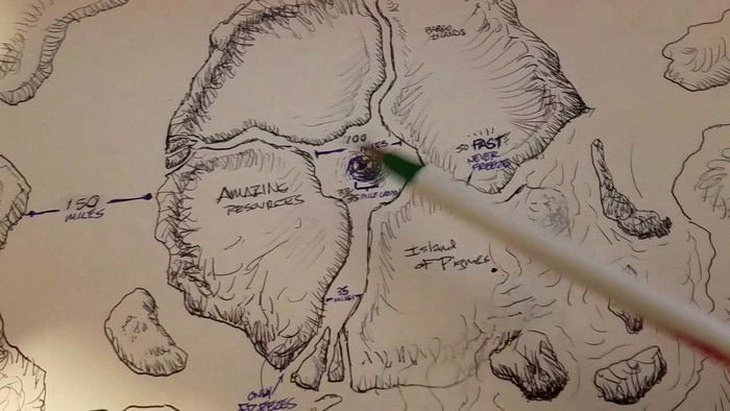
Rupes Nigra, which literally means Black Rock, was an island that was allegedly located at the magnetic north pole. It was claimed to be a 33 mile-wide magnetic island, which was meant to explain why all compasses point north. It was added to maps from the 16th and 17th centuries, before being excised from them later on.
6. Buss Island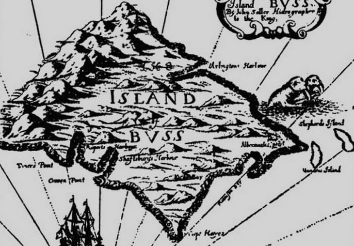
One of the most persistent phantom islands ever to have appeared on maps is Buss Island. It was first 'discovered' by Captain James Newton in 1578, who said it was full of forests and fruit. Since this claim, many others have confirmed that such a place exists, and a captain called Thomas Shepherd even said that he explored it and mapped it. Since it has never been seen since many people simply presume that it had sunk for some mysterious reason.
7. Emerald Island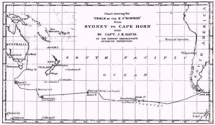
In the 1820s, British explorers, including Captain William Elliot and his crew, claimed to have discovered an island between Antarctica and Australia, which was small and covered in mountains. All other expeditions ended in failure, but for some reason Emerald Island was featured in atlases and maps until 1987.
8. Saint Brendan’s Isle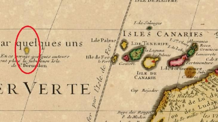
Saint Brendan’s Isle was allegedly located in the North Atlantic, and was named after Saint Brendan, the man who first discovered it. It was even featured on Christopher Columbus’s own maps. Nowadays, many people claim to have seen the isle, including the Scottish monk, Sigbert de Gembloux.