“A map says to you. Read me carefully, follow me closely, doubt me not... I am the earth in the palm of your hand.” - Beryl Markham (Aviator)
I love finding random maps on the internet. They are so fascinating and tell us little details we never knew before. For instance, did you know there’s a map that shows which countries were not invited to Queen Elizabeth II's funeral? There’s even one that reveals the countries where it has never snowed before!
We have shared many interesting maps below. I wasn’t really fond of geography when I was at school, but these cool and informative maps make me see our planet from a different perspective.
Related: There’s a Map for Literally EVERYTHING in the World!
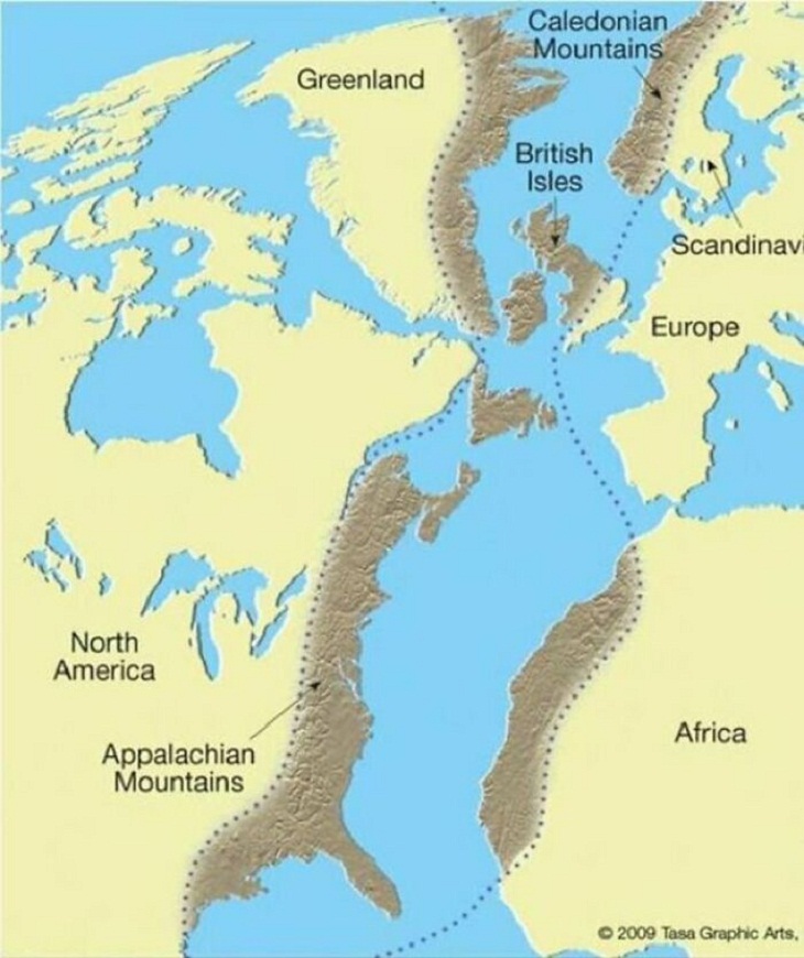
1. "The Scottish Highlands, the Appalachians, and the Atlas are the same mountain range, once connected as the Central Pangean Mountains"
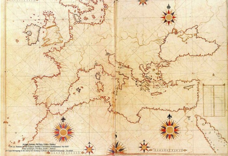
2. A map drawn by Turkish sailor and cartographer Piri Reis in 1513
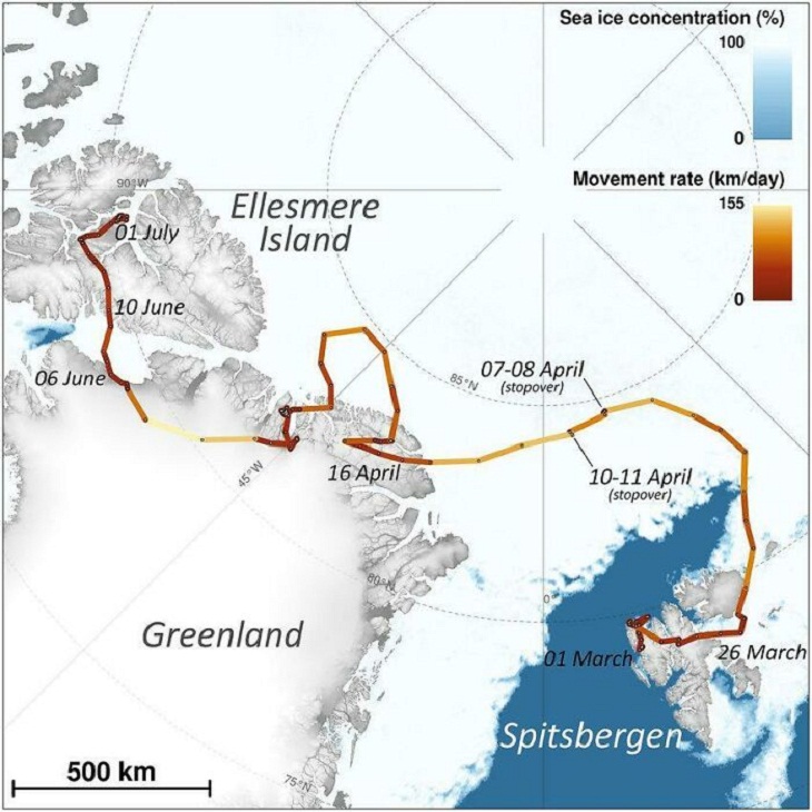
3. This map traces the remarkable journey of an Arctic fox who walked from Norway to Canada in 2018
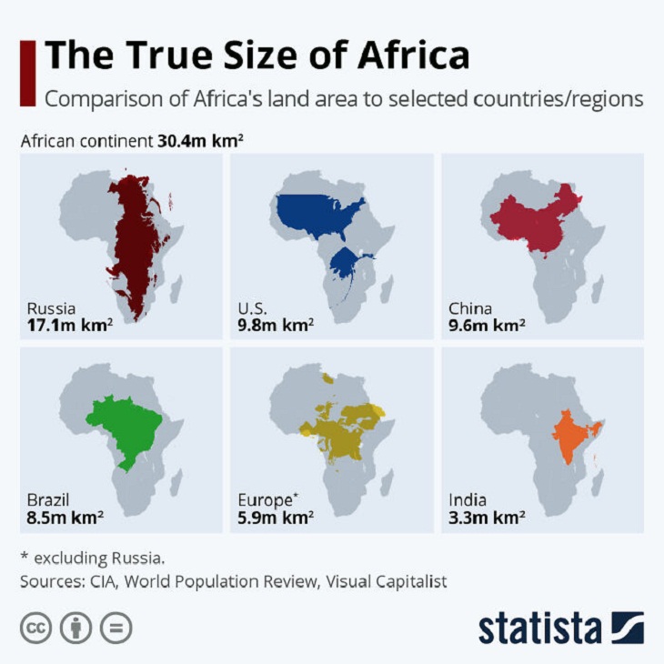
4. The true size of Africa
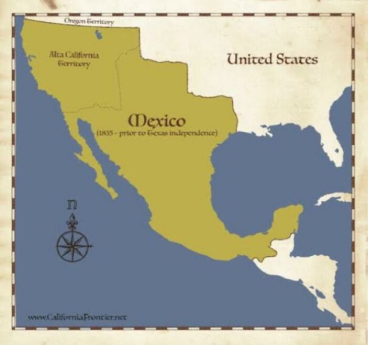
5. Mexico’s borders in 1835
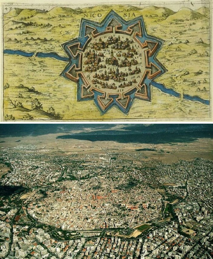
6. A 16th-century map of Nicosia, Cyprus. The picture below it shows what the city looks like today
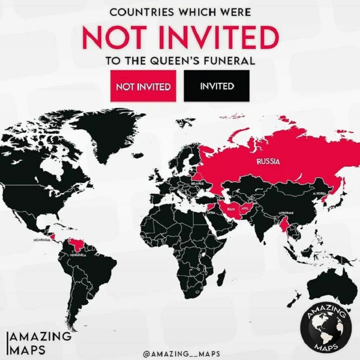
7. These countries were not invited to Queen Elizabeth II's funeral
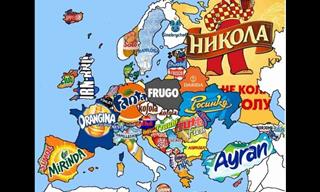
8. Interesting!
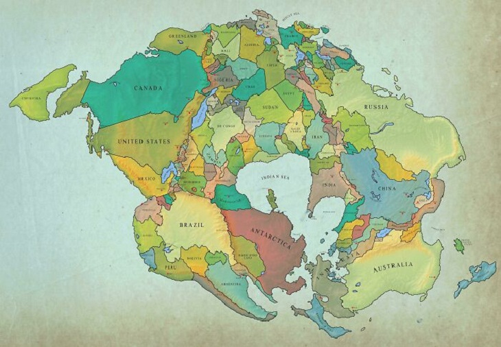
9. This is what Earth might look like with current international borders in 250 million years
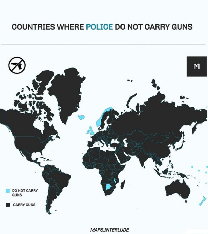
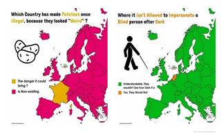
10. Countries where police don’t carry guns
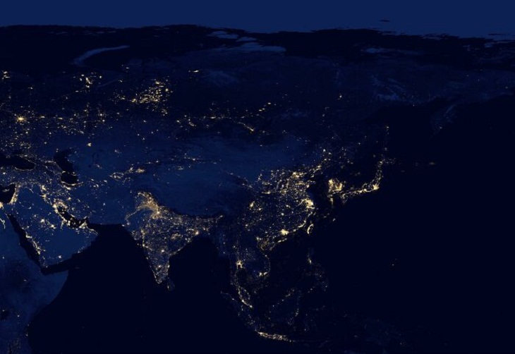
11. The continent of Asia at night
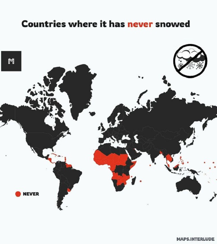
12. It has never snowed in these places, apparently
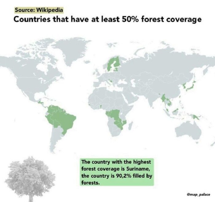
13. Countries with at least 50% forest coverage
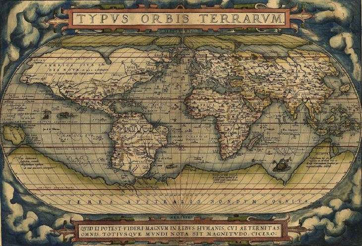
14. Theatrum Orbis Terrarum (Latin for “Theatre of the Orb of the World”) is considered to be the first real modern atlas. It was compiled by Abraham Ortelius in 1570 in Antwerp, Belgium
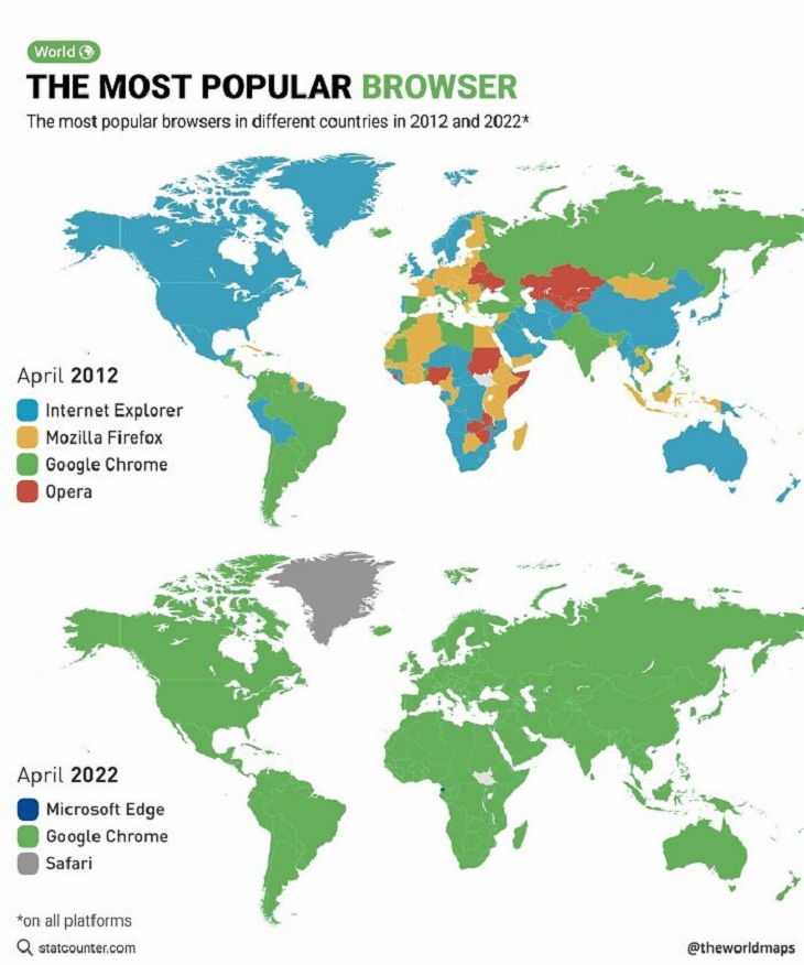
15. The most frequent web browser used in every country - 2012 vs. 2022
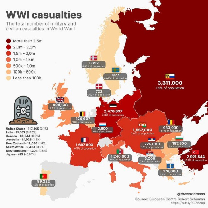
16. Fatalities caused by World War I
Share these maps with your friends and family...