The Maya civilization is one of the most mysterious ancient civilizations in history. The territory that was once home to this highly sophisticated Central American civilization, complete with interconnected cities and organized agriculture, is now consumed by the Maya Biosphere Reserve, the largest rainforest in Central America.
And that rainforest is hiding far more mysterious than we once thought. An ongoing archeological project conducted by a group of scientists in Guatemala is determined to uncover the secrets of the ancient Maya civilization using novel laser technology. And they already found more than anyone had ever expected - over 60,000 undiscovered Maya structures.
The Maya Biosphere Reserve takes up 4.3 million acres (1.7 million hectares) of Guatemala, which is roughly one-fifth of the entire country. The reserve encompasses a vast area of forests, savannas, wetlands, rivers, and lakes, and it is home to countless endemic wildlife and plantlife.
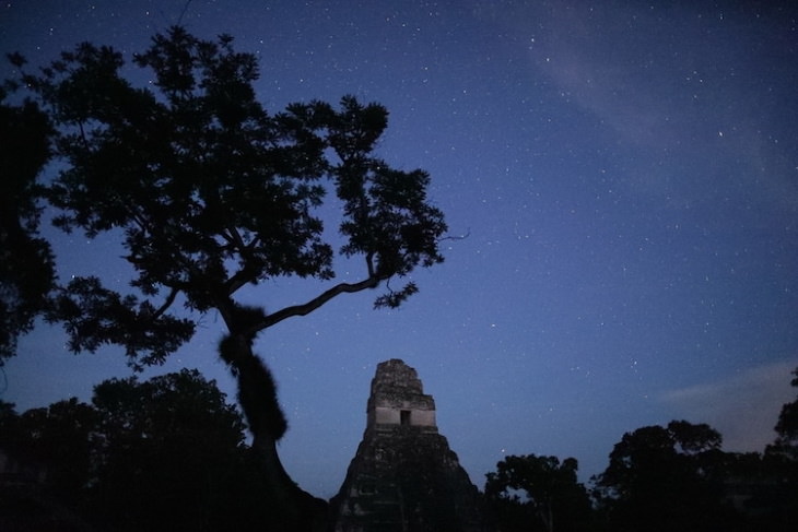
But some five centuries ago, this vast landscape was also home to the Maya, arguably the most advanced civilizations in Central America. The Maya ruled over this region for almost a thousand years - approximately from 750 BC until 1667, the end of the Spanish conquest. We know very little about this ancient civilization - for which the rainforest may be partly to blame.
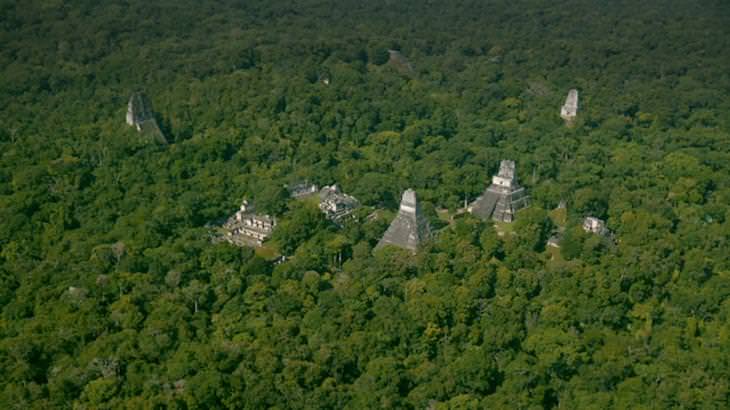
The thing is, the dense jungle environment made it extremely challenging for archeologists to locate potential digging sites. A cutting-edge laser technology called Lidar removes that obstacle. The technology was used in 2016 to scan 800 square miles of the forest around Tikal, the largest Maya city and the most famous archaeological site in Guatemala.
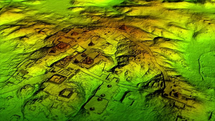
Lidar works by beaming a laser from a hand-held scanner from an airplane or up-close. The technology creates a virtual 3D map of the area, omitting the vegetation and leaving only the topography of the area. “There are entire cities we didn’t know about now showing up in the survey data,” said archaeologist Francisco Estrada-Belli, one of the leading scientists with the Foundation for Maya Cultural and Natural Heritage (Pacunam) which launched the project.
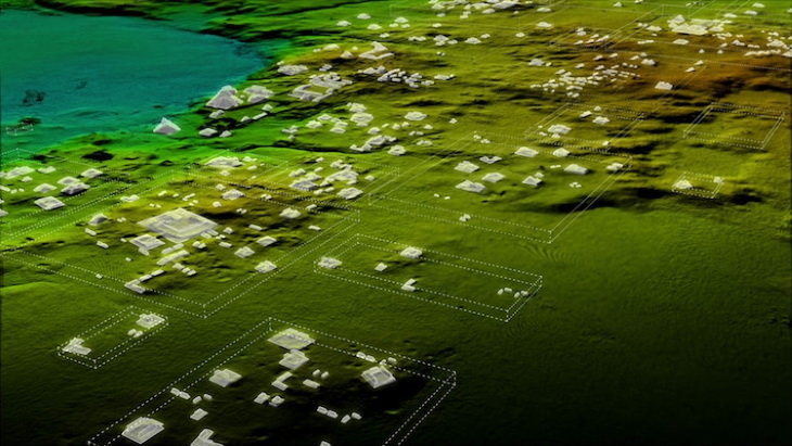
All in all, the researchers have located 60,000 previously unknown Maya structures, including temples and pyramids. The mapping revealed that the Maya built raised roads to connect their cities, they created intricate irrigation systems to promote agriculture, and knew how to prevent soil depletion.
The new data also found thousands of residential homes, which helped scientists understand that the population of the territory was 11 million, nine million more than previously estimated. This puts the Maya on the same level as ancient Egyptian and ancient Chinese civilizations, both in terms of their population and level of advancement.
The 2018 study is already the biggest archaeological survey of the Maya civilization, but it is only the beginning for archeologists. “There are 20,000 square kilometers more to be explored and there are going to be hundreds of cities in there that we don’t know about. I guarantee you,” said Estrada-Belli. View the Lidar technology in action and see some of the structures it helped uncover in the video below.
Share this fascinating information with other history buffs!