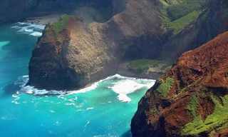
Google Earth is a pretty incredible tool. Even if you are not using it for navigation, you can discover many interesting places from around the world through it. A geologist, Will, who goes under the nickname geologistmakesthebedrock, has been collecting and sharing some really cool places he found from this wonderful program. Many of those places are man-made structures while several others are surreal-looking land formations. Here, we have shared some of his best finds. From beautiful volcanoes to stunning islands, these places look so fascinating on Google Earth. Take a look.
See Also: 11 Shocking Things Discovered - On Google Earth
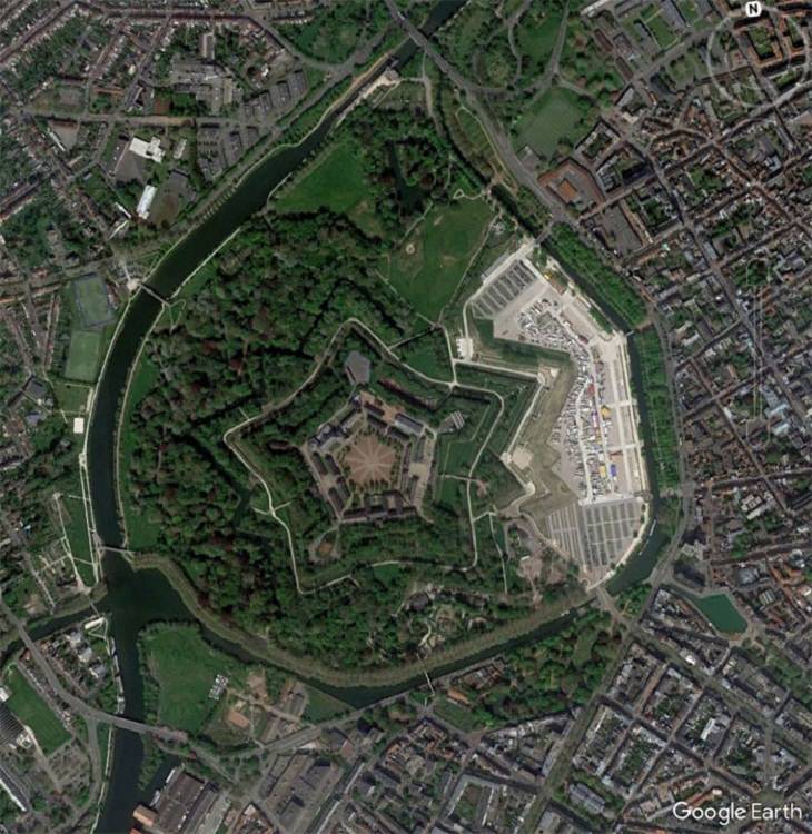
1. A fort in Lille, France.
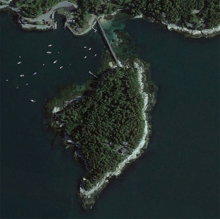
2. A private island on the coast of Maine. The bridge has a gate, and the house overlooks a shipping lane in Penobscot Bay.
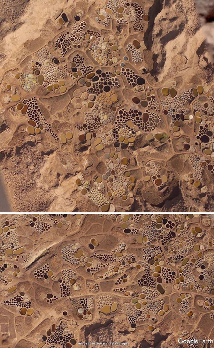
3. This looks like an abstract painting but these are pits that are used in a very old-fashioned salt extraction operation.
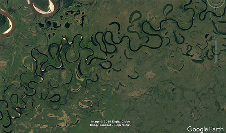
4. An extremely serpentine river. Almost looks like a painting...
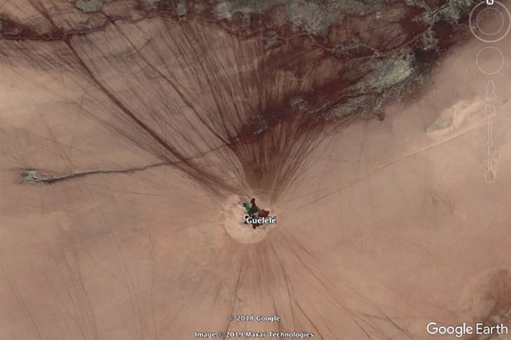
5. A real live oasis! The lines you see are tracks from cars. The smaller ones must be of animals.
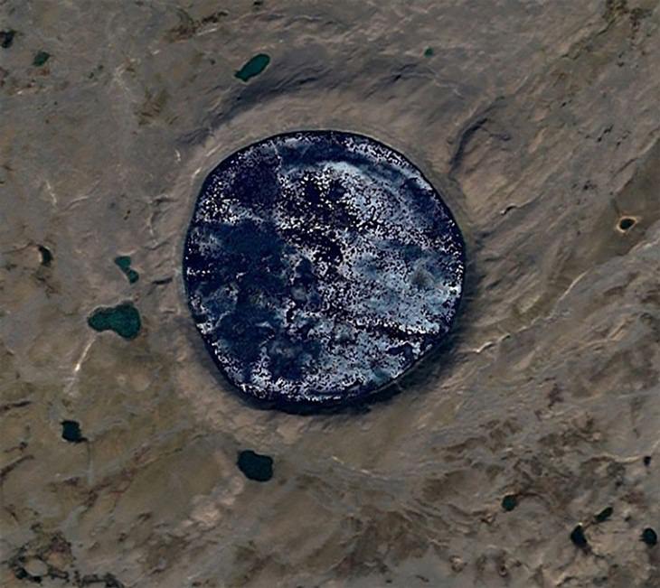
6. A perfect meteor crater with a very nice raised rim.
7. The circular reflections of these waves look so cool.
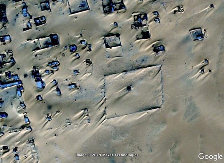
8. This is Assamakka, a small town in Niger. The community has to battle with the raging sands every single day.
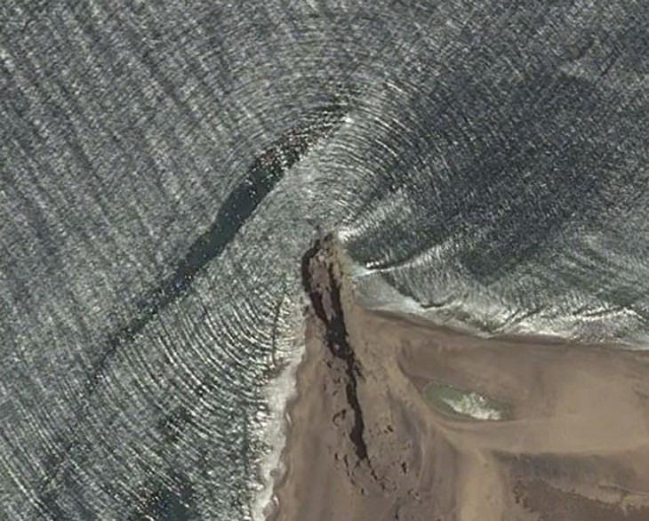
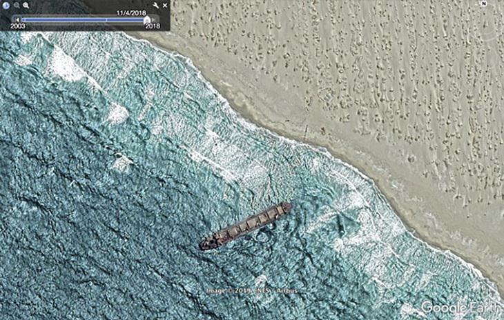
9. A shipwreck on a desert coast in North West South Africa.
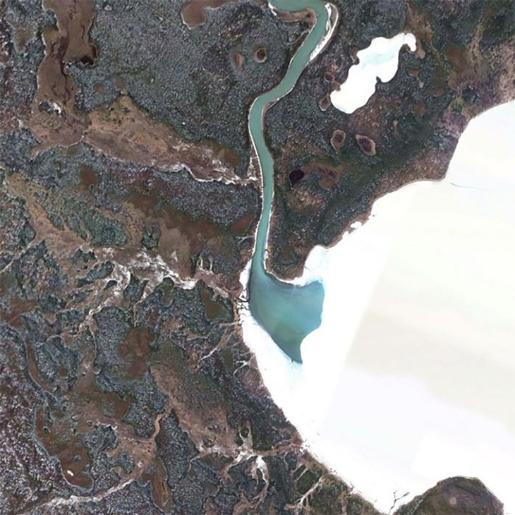
10. A river cutting a hole in the ice.
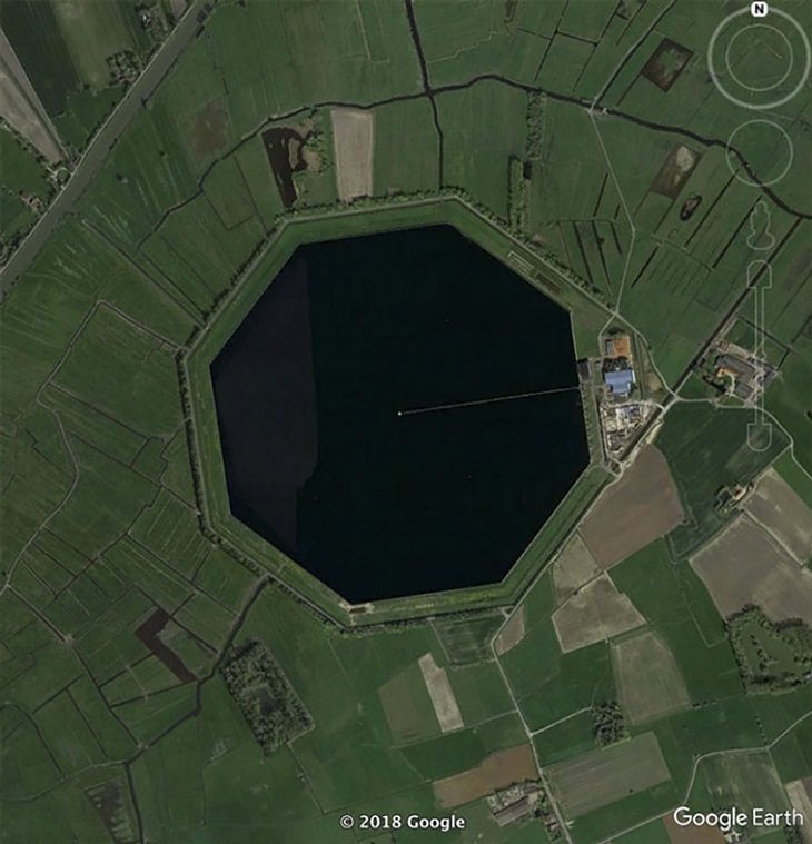
11. Some sort of reservoir in Belgium with an unusual octagonal pond.
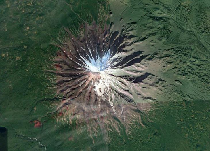
12. This volcano on the Kamchatka Peninsula in Russia looks so well-formed.
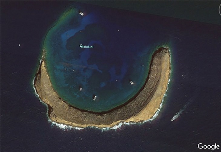
13. An atoll, also known as a coral atoll, is a ring-shaped coral reef, island, or series of islets, that encircles a lagoon partially or completely.
14. A volcano poking up out of the South Pacific.
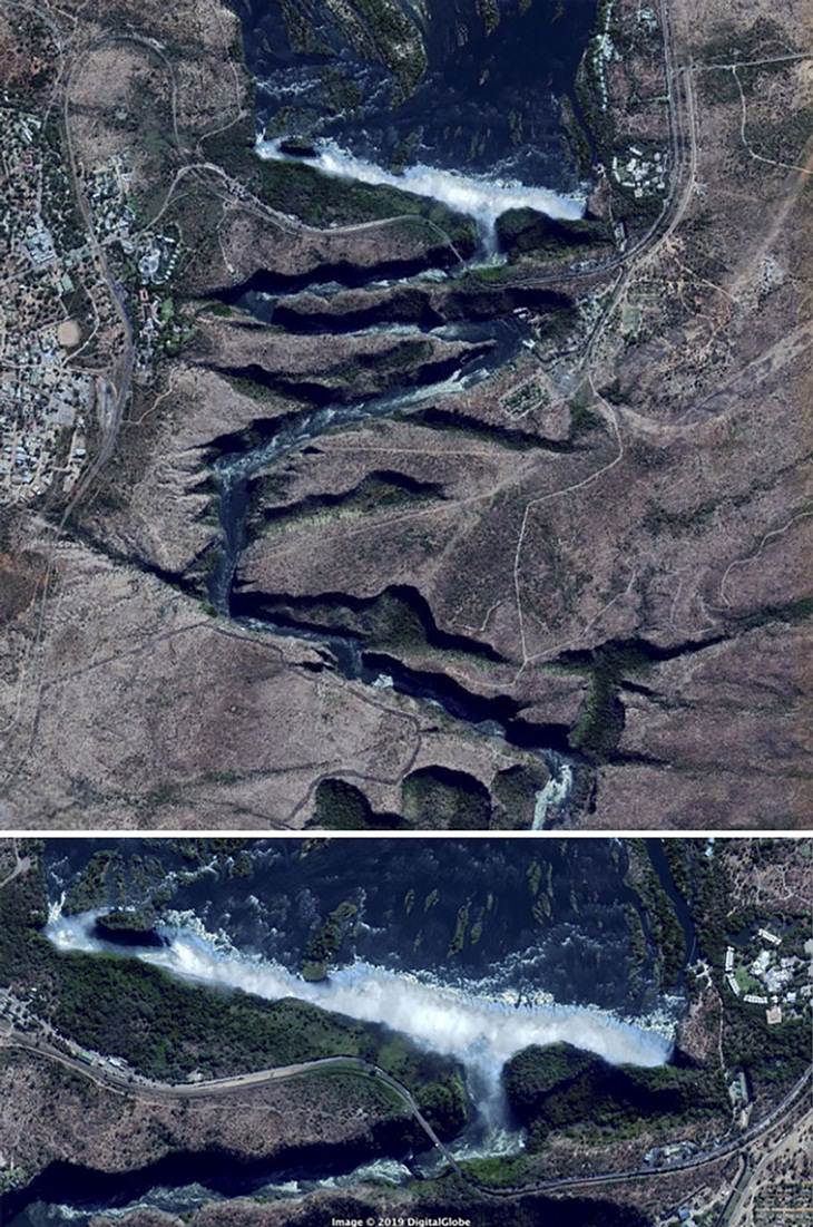
15. The Zambezi River in Africa downstream of the falls. The path of the river seems rather unusual.
Share these images with your loved ones!