Back in the late 19th and early 20th centuries, illustrated panoramic maps were quite popular in America. These maps were commonly known as "balloon maps” then, as they were mostly drawn by artists in hot air balloons. However, they were also called bird’s eye views, aero views, and even perspective maps.
Many artists couldn’t get on hot air balloons to draw these maps. Instead, they chose some high vantage points where they could get equally great views of the cities and towns they wanted to illustrate. These panoramic maps, though not generally drawn to scale, provided people with a good view of their local area and were often posted in the common areas of cities to help people get around.
Initially, these illustrated maps were quite simple and included the basic details, but with time, more specifics, like various street patterns, individual buildings, and major landscape features were also added. As their popularity grew, these maps even came in handy to help tourists explore American cities. By the early 20th century, these illustrated panoramic maps were seen as symbols of pride for their cities by their citizens.
The Library of Congress has an extensive collection of these vintage illustrated panoramic maps that are available for viewing. Here we present some of the best-illustrated maps from 19th century America that provide a beautiful look of the country from back in the day.
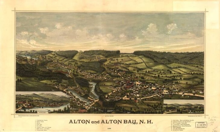
1. Alton and Alton Bay, New Hampshire, 1888
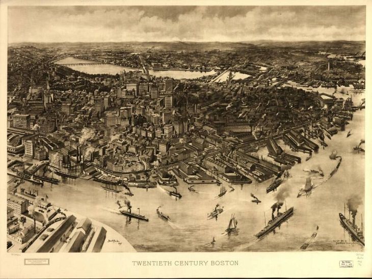
2. 20th century Boston
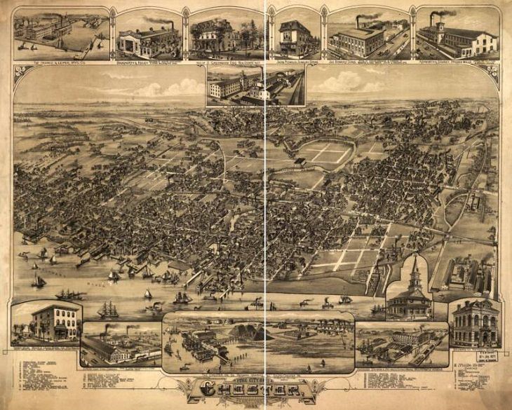
3. The city of Chester, Pennsylvania, 1885
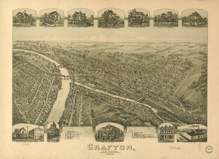
4. Grafton, West Virginia, 1898
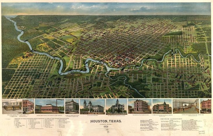
5. Houston, Texas, 1891
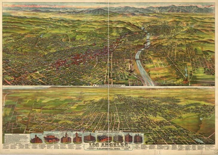
6. Los Angeles, California,1894
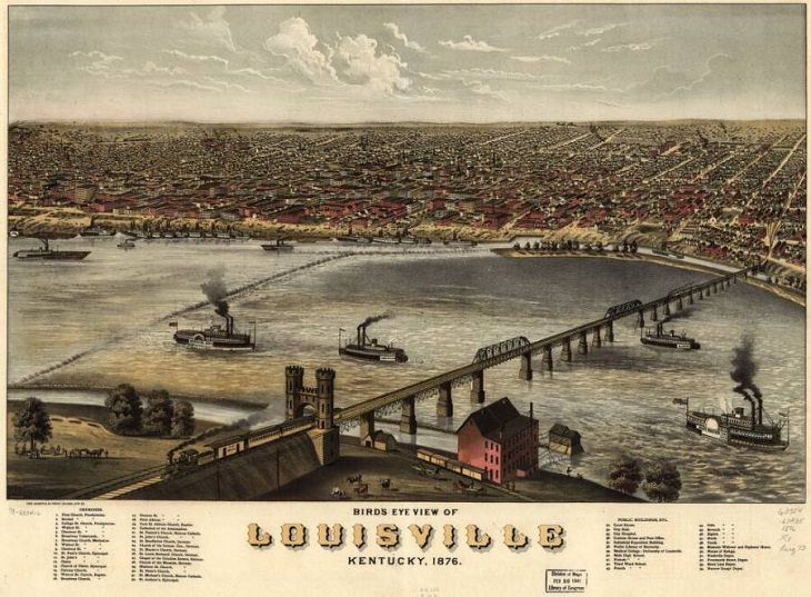
7. Louisville, Kentucky, 1876
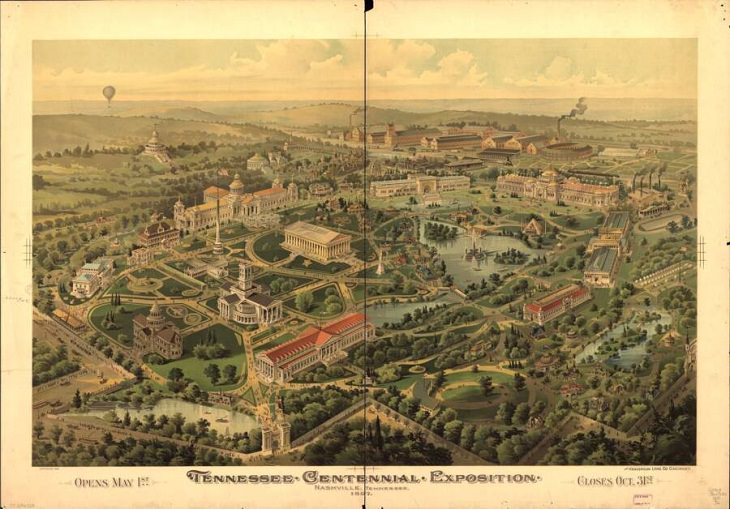
8. Nashville, Tennessee, 1897
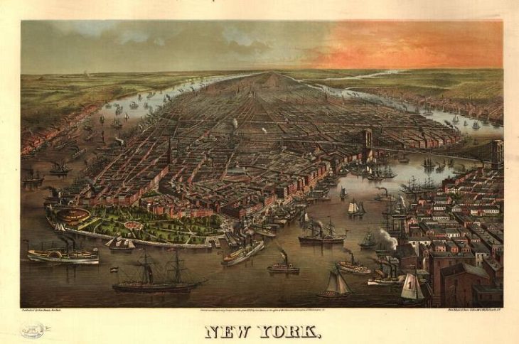
9. New York, 1873
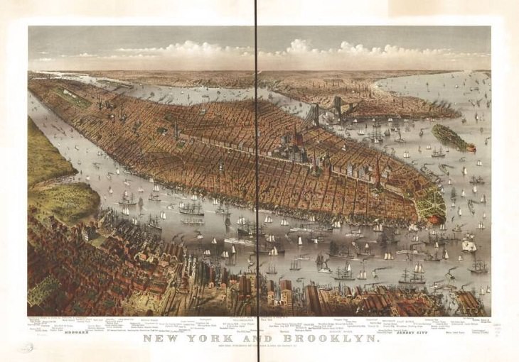
10. New York and Brooklyn, New York, 1875
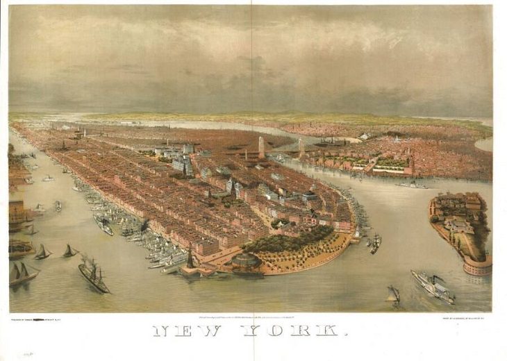
11. Bird's-eye view of New York, 1874
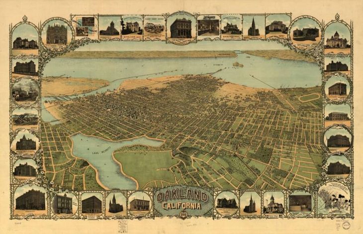
12. Oakland, California, 1900
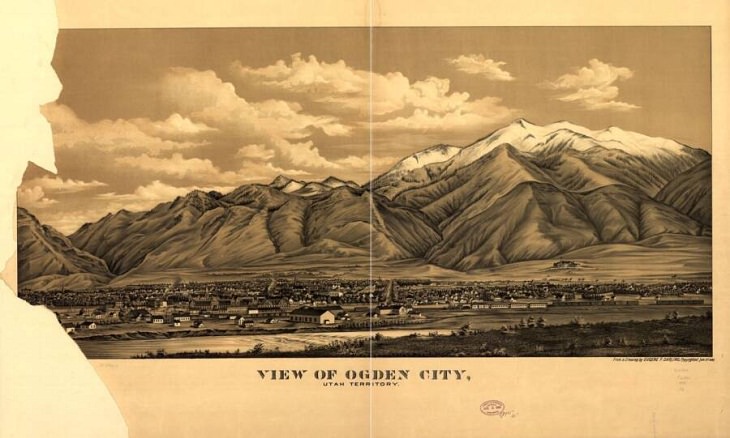
13. Ogden, Utah, 1889
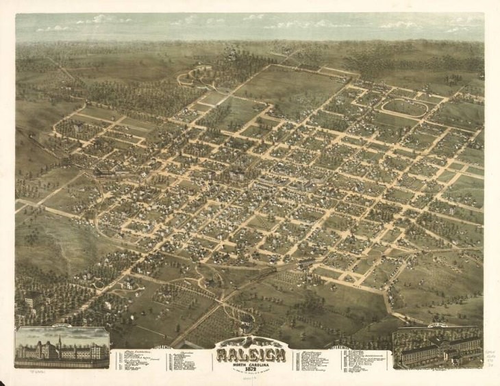
14. Raleigh, North Carolina, 1872
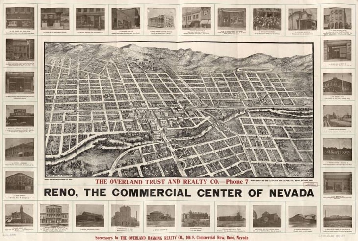
15. Reno, Nevada, 1907
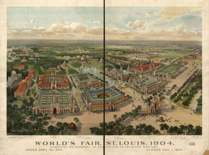
16. St. Louis, Missouri, 1904
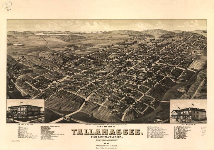
17. Tallahassee, Florida, 1885
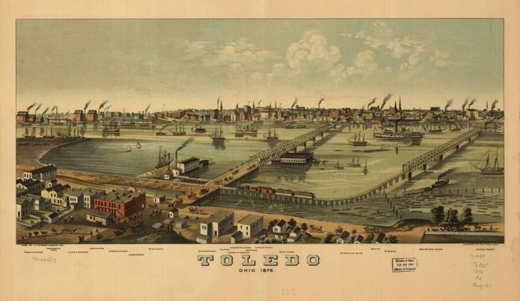
18. Toledo, Ohio, 1876
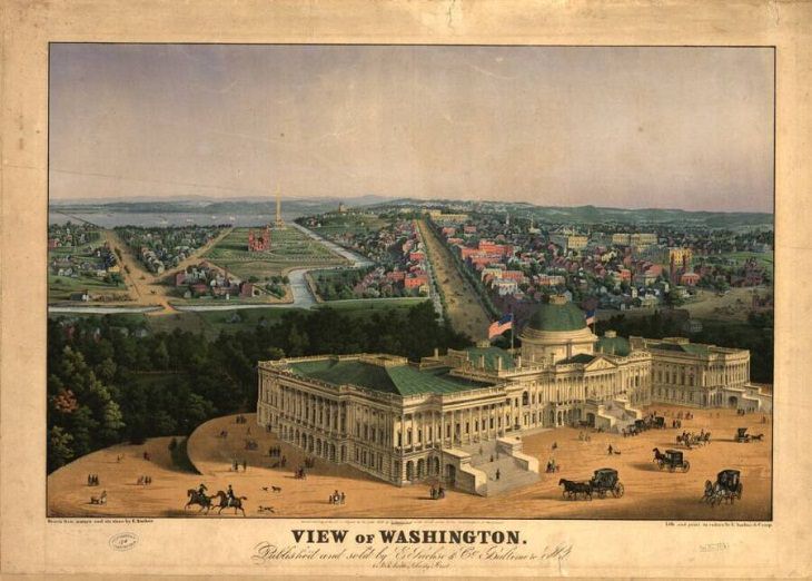
19. Washington, D.C., 1852
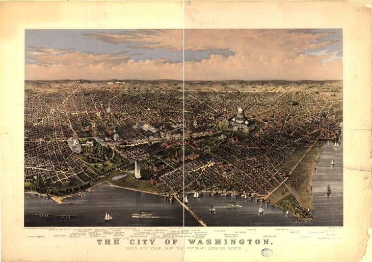
20. Washington D.C. Potomac River, 1880