|
Looking down from the heavens, these photos represent what satellites, hovering above the atmosphere, can see from high up, revealing a whole new world of shapes. The world can look more organized than it seems from down below, and these photos give a whole new meaning to the landscapes we're used to seeing. Don't miss out on the video explaining this amazing phenomenon called: "The Overview Effect". |
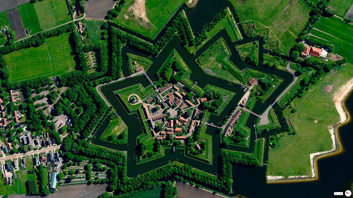
| Bourtange, Vlagtwedde, Netherlands |
 |
|
|
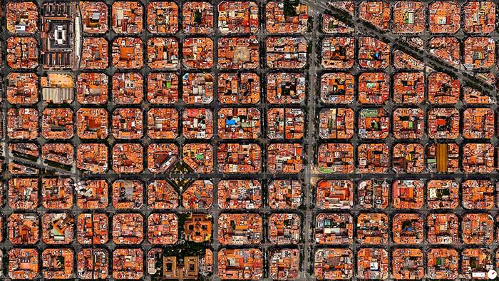
| Barcelona, Spain |
 |
|
|
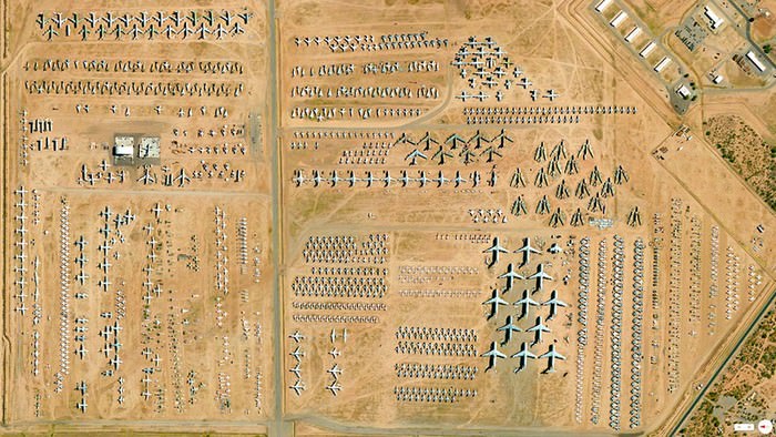
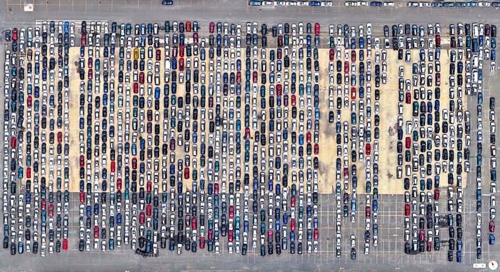
| 309th Aerospace Maintenance and Regeneration Group Tucson, Arizona, USA |
 |
|
|
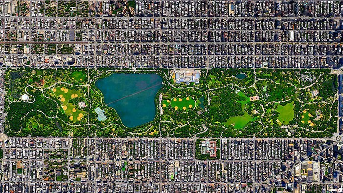
| Central Park, New York City, New York, USA |
 |
|
|
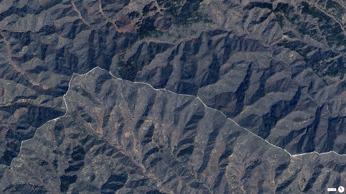
| Great Wall of China, Northern China |
 |
|
|
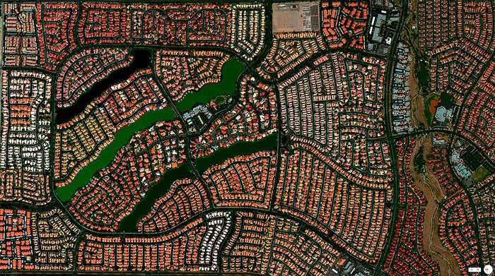
| Desert Shores Community, Las Vegas, Nevada, USA |
 |
|
|
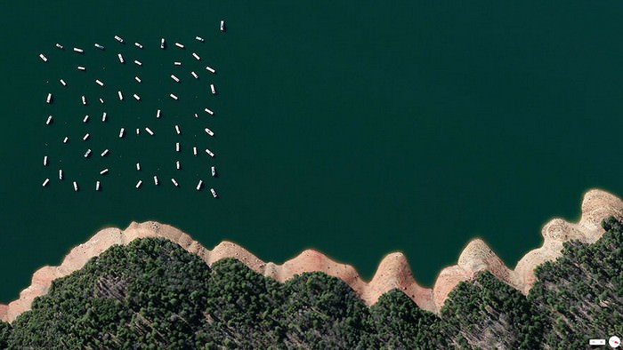
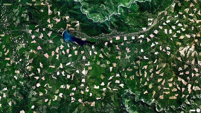
| New Bullards Bar Reservoir, Yuba County, California |
 |
|
|
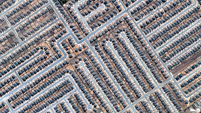
| Residential Development, Killeen, Texas, USA |
 |
|
|
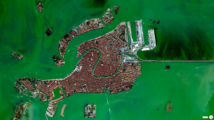
| Venice, Italy |
 |
|
|
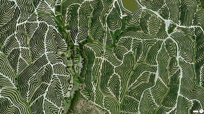
| Vineyards, Huelva, Spain |
 |
|
|
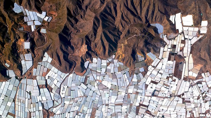
| Plasticulture / Greenhouses, Almeria, Spain |
 |
|
|
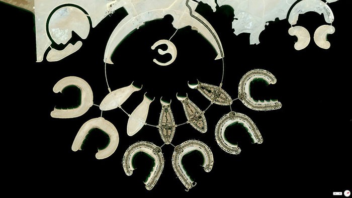
| Durrat Al Bahrain, Bahrain |
 |
|
|
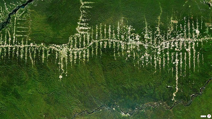
| Amazon Rainforest Deforestation, Para, Brazil |
 |
|
The 'Overview Effect' explained: |
|
|
| Port Newark-Elizabeth Marine Terminal, Newark, New Jersey, USA |
 |
|
|
|
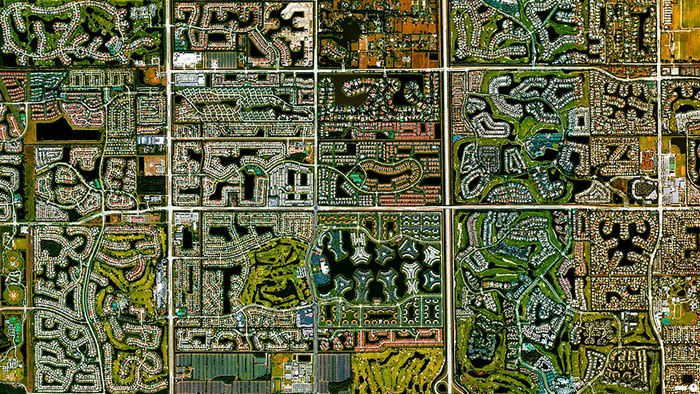
Boca Raton, Florida, USA
|
 |
|
|
|
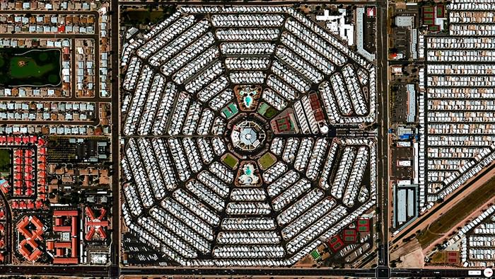
Venture Out RV Resort, Mesa, Arizona, USA
|
 |
|
|
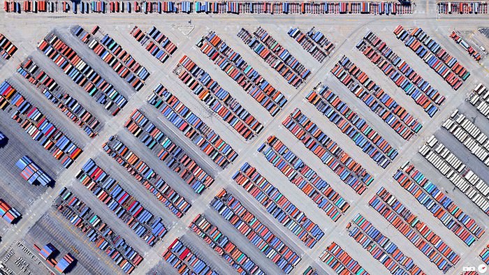
| Port of Los Angeles, Los Angeles, California, USA (containers) |
 |
|
|
|
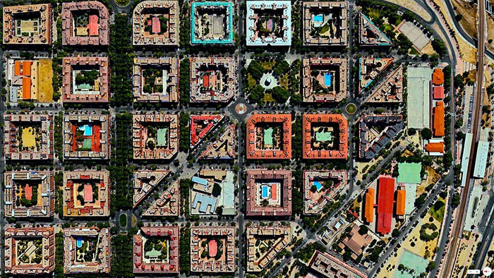
Puente de Vallecas, Madrid, Spain
|
 |
|
|
|
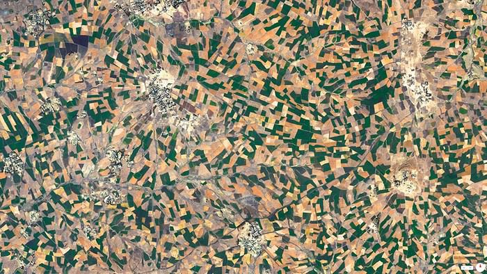
Agricultural Development, Addis Ababa, Ethiopia
|
 |
|
|
|
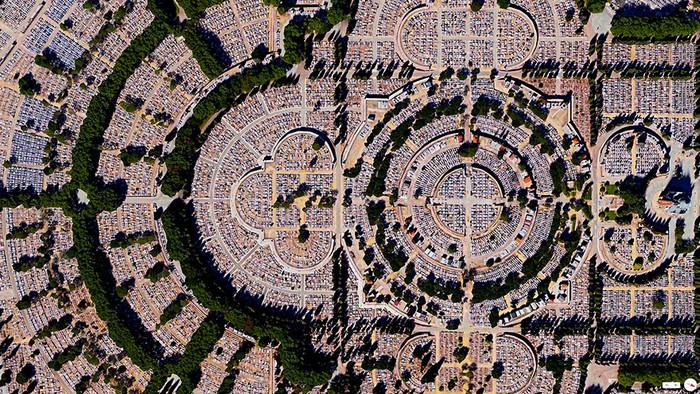
Our Lady of Almudena Cemetery, Madrid, Spain
|
 |
|
|
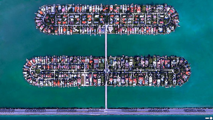
| Palm Island / Hibiscus Island, Miami Beach, Florida, USA |
 |
|
|
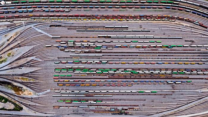
| Inman Yard, Atlanta, Georgia, USA |
 |
|
|
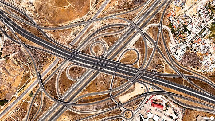
| Spaghetti Junction (A-3 and M-50), Madrid, Spain |
 |
|
|
|
Agricultural Development, Loxahatchee, Florida, USA
|
 |
|
|
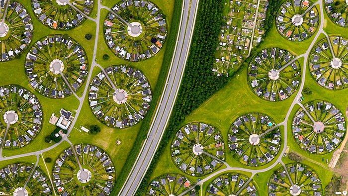
| Brøndby Haveby, Brønby Municipality, Denmark |
 |
|
|
|
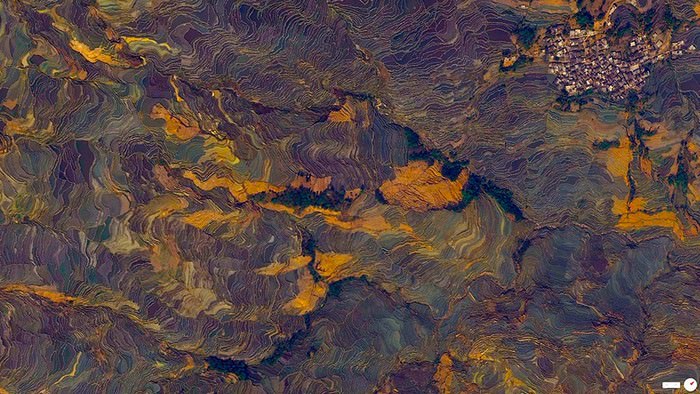
Terraced Rice Paddies, Yuanyang County, Yunnan, China
|
 |
|
|
| Clearcutting in the El Dorado National Forest, Georgetown, California, USA |
 |
|
|
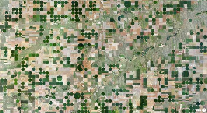
| Edson, Kansas, USA |
 |
|
|
|
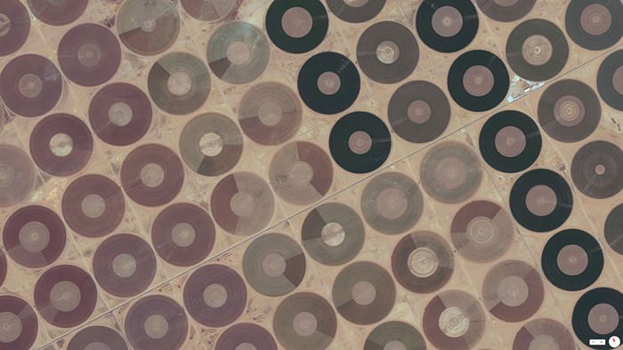
Central Pivot Irrigation Fields. Ha’il, Saudi Arabia
|
 |
|
|